Abdulazeez Shehu* | Mohammed Saleh | Abubakar M. Hotoro | Abdulrahim A. Bunawa
© 2020 IIETA. This article is published by IIETA and is licensed under the CC BY 4.0 license (http://creativecommons.org/licenses/by/4.0/).
OPEN ACCESS
Ground Magnetic measurement was carried out with the aim of delineating the subsurface structures on Dala hill, Kano State. Total magnetic intensity data were acquired using the SCINTREX proton precession magnetometer along closely spaced traverses. The acquired total magnetic intensity data were reduced and plotted using Golden Surfer software to produce the 2D and 3D surface maps for visual inspection. Five profiles AB, CD, EF, GH and IJ were selected for forward modelling using Mag2dc software to give detail information about the causative body parameters. The depths of these bodies from the surface fall in the interval 0.0 m to 8.5 m. The high magnetic anomaly field ranges from -21,752 to 47,205 nT which suggested area of iron occurrences. The study categorized the identified major anomalous features into two: the shallower bodies which penetrated down to a maximum depth of 67.3 m were inferred to be disturbed sediments, fire pits and kilns; whereas the rest, the deep-rooted features with greater depth of penetration reaching up to 193.2m, have high susceptibility range of up to 7.3 SI units, were interpreted to be intrusive ferromagnetic bodies. The findings of the study were in close agreement with recent archaeological findings about the hill.
antiquities, anomaly, ferromagnetic, iron-ore, forward modelling, Mag2DC, susceptibility
TThe study area which is the Dala hill located in Dala Local Government Area lies between latitudes $12^{\circ} 00^{\prime} 00^{\prime \prime} N$ to $12^{\circ} 03^{\prime} 21^{\prime \prime} N$ and longitudes $8^{\circ} 27^{\prime} 30^{\prime \prime} E$ to $8^{\circ} 31^{\prime} 40^{\prime \prime} E$ of Kano state have traces of iron ore body which was once exploited by the early settlers of this region. According to the historical accounts from natives of the area, Dala was named after a hunter who once lived at the hill. They claimed that the entire area where the hill is today was a deep forest until their forefathers decided to settle down around it [1]. Dala Hill is an archaeological site of an ancient settlement dating back to the 10th century AD. It is the source of the evolution of Kano City and a vital reference point in the development of Hausa Kingdoms, societies and cultures which greatly influenced the early indigenous civilizations in the savannah zone of the Western African sub region [2]. Dala hill located in Kano State which lies on the Basement Complex rocks of northern Nigeria located northwest of the State. Figure 1 shows the basement complex rocks of Kano State. Basement rocks are buried under the thick weathered layer and rarely exposed [3]. Dala hill is a lateritic hill which rises to a height of about sixty meters and can be climbed using stairs built on the front face of the hill. Though the hill is rough on the sides caused by weathering but it’s remarkably cool and flat at the top. The flat top of the hill is covered by coarse grain lateritic
Showing the Study Area (GIS LAB GEO DEPT BUK, 2017) sediments and a few presents of rock outcrops [2]. Local deposits of iron ore, mining activities, ore smelting and metal work have been reported in the past history of Dala region of Kano State [4]. But in the recent times, nothing much has been done to determine whether the deposits are still available or viable in quantity and quality for commercial exploitation. The investigation of iron ore deposit cannot be overlooked because of its economic importance and demand by steel manufacturing industries [5]. Iron is the world's most commonly used metal and represents almost 95% of all metal used per year [6]. Iron and steel are recognized as the keystones to any country’s industrial development and a means of accelerating socio-economic development [7].
Kassim (2014) successfully used the ground magnetics geophysical method to delineate regions of small scale iron ore deposits in Kimachia area [8]. The study, carried out on the eastern parts of Nyambene ranges confirms of small scale iron deposits. The deposits are suspected to be part of a larger iron rich zone [9]. Kayode et al reported in their research titled “Interpretation of ground magnetic data of Ilesa, South-western Nigeria for potential mineral targets”, carried out ground magnetic study of Ilesa, South-western Nigeria. The results generated were used to delineate geological structures and to target areas with mineral potential which has helped in many ways serve great benefits for the solid minerals sector of Nigeria economy [10]. In relation to these activities, subsurface characteristics of particular interest to earth scientists include the location, distribution and structure of rock types, grain size distribution and material strength, porosity and permeability, to name a few. The earth's inherent complexity can make it difficult or impossible to infer these characteristics from direct observation [11]. If the shape and magnetic properties of a buried archaeological feature were known, the resulting magnetic anomaly could be calculated [12].
A thermo-luminescent dating of some man-made relics conducted at United Kingdom for Bayero University's History Department suggests that man was actively engaged in iron smelting culture in Kano at about 320 - 380 AD. So conclusively people must have been there for more than one thousand years to develop such skills of iron smelting [13]. Recent archaeological/geologic activities have collected these antique materials which have appearance of the ancient origin and workmanship. All these approaches relied on physical appearance and superstitions. Moreover, they relied on shallow or near surface features. In particular, the geologic archaeology required disturbing the environment by digging and the likes. Thus, this approach could not answer a lot of questions regarding attributes of the hill with great certainty. But the geophysical approaches, especially ground magnetics could help tremendously in answering some of the questions, typicality’s of which include the depth extent of influence of ancient anthropogenic activities, the location of metallic sources of materials used by the ancient settlers etcetera. In addition, this method, the ground magnetic has the advantages of being very cheap, fast and it does no harm to the environment of its application. Thus, the scarcity of the geophysical studies conducted and the geologic importance of the study area motivated us to carry out this study. The aim of this study was to carry out the ground magnetic measurement on Dala hill with the goal of delineating the subsurface structures of the hill.
Figure 1. Basement complex rocks of kano state
The remainder of this paper is organized as follows: Section 2 describes the materials used, the field lay out, and the mode of data acquisition and data reduction; Section 3 discusses results obtained from the field, the interpretation of Geophysical data which involves expressing the information obtained from the surface measurements in geological terms; and Section 4 gives the summary, conclusion of the research findings and recommendation for further studies.
In magnetic prospecting, the susceptibility is the fundamental material property whose spatial distribution we are attempting to determine. A body placed in a magnetic field acquires a magnetization which, if small, is proportional to the field given by Eq. (1) [14]:
J = kH (1)
where, the intensity of magnetization, J, is related to the strength of the inducing magnetic field, H, through a constant of proportionality, k known as the magnetic susceptibility [14]. The susceptibilities, in rationalized SI units, of some common ore minerals are given in Table 1.
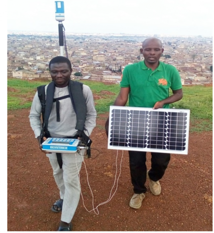
For this research, the ENVI PRO portable proton-precession magnetometer made by SCINTREX Company of Canada was used for magnetic data acquisition as presented in Figure 2.
Other materials used include: Global Positioning System (GPS), Computer system, Golden surfer v15 and Mag2dc v2.11. The methods employed in this research started with ground magnetic data acquisition to data transfer, data reduction, production of 2D and 3D magnetic anomaly maps, data analysis and interpretation.
Table 1. Magnetic susceptibilities of selected minerals (adopted from Dobrin and Savit, 1988)
|
Minerals |
Susceptibility |
|
Pyrite |
0.0001–0.005 |
|
Hermatite |
0.001–0.0001 |
|
Phyrrhotite |
0.001–1.0 |
|
Chromite |
0.0075–1.5 |
|
Magnetite |
0.1–20.0 |
Figure 2. Magnetic data acquisition on dala hill
Total magnetic field intensity measurements were undertaken on Dala hill along selected survey lines using the WalkMag mode. The readings were recorded automatically every 0.5 second as the operator walked. Two meters spacing was given between the selected survey lines. Data reduction was carried out on the acquired magnetic data to correct for diurnal and geomagnetic variations using equations (2a; b) and (3) respectively.
Drift $=\frac{B \text { base }, f-B \text { base }, i}{\text { tbase }, f-\text { tbase }, i}$ (2a)
where, Drift is the drift of measurement in a loop; B base, f and B base, i are the final and initial total magnetic field at the base station; tbase, f and tbase,i are the final and initial time at the base station.
Bdrift, n=B n-drift (tn-tbase) (2b)
where, Bdrift, n is corrected magnetic field at the nth station in the loop; Bn is the total magnetic field at the nth station; tn is the measuring time at the nth station; tbase is the measuring time at the first station of the loop [15].
Residual field=Diurnal Crtd Total field-Geomagnetic Field (3)
For this research, the geomagnetic field data were deduced from the Planer Regression relation of the first order given by Eq. (4):
Z = AX+BY+C (4)
Surfer Golden surfer v.15 software was then used for gridding and to plot contour map to establish the anomaly signature of the area. Forward modelling was employed in the quantitative interpretation using Mag2dc software developed by Cooper (2004) which calculates the anomalous field caused by an assemblage of 2-dimensional magnetic bodies defined by a polygonal outline. Description of the method of the program mag2dc can be found in the work of Kravchinsky et al. [16].
In this study both qualitative and quantitative methods of interpretation were applied.
3.1 Qualitative Interpretation of Dala Hill Magnetic Data
The Residual magnetic data obtained after carrying out diurnal and geomagnetic corrections were used to create 3-D Magnetic Surface map and Residual contour map for visual inspection and qualitative interpretation (Figures 3 and 4).
The 3-D surface plot of the corrected total magnetic intensity in the study area showed high magnetic signatures around north-central, central, south-eastern and south-western regions of the plot, where the crests and troughs represent areas of positive and negative magnetic anomalies, respectively. On the other hand, the north-eastern and north-western parts are magnetic quit zones.
The Residual Anomaly contour map of the Dala hill in Figure 3 shows a range of magnetic residual anomaly values rising to about 47,205 nT high while having the lowest value of about -21,752 nT.
The magnetic anomaly map is characterised by small, medium and large anomalous bodies and several pits identified as A, B, C, D, E, F, G, H, I, J, K, L, M, N, P and R. Magnetic mineral ore within the subsurface rocks may be obscured by the thick cover lateritic sediments on the hill. This is in agreement with the closed successive contours (Figure 4) with anomaly increasing towards the center. The anomalies on the hill show four major orientations: SE-NW, SW-NE, S-N and E-W orientations.
Figure 3. 3-D Magnetic Residual Surface Map of Dala Hill
Figure 4. Residual contour map of the dala hill with profiles drawn across
3.2 Quantitative interpretation
The results presented show the modelled bodies of the subsurface structures causing anomalies on the selected profiles AB, CD, EF, GH and IJ. The bodies are labelled a, b, c, d, e, f, g, h or i from left to right in all the five modelled profiles on the anomaly map.
Profile AB lies along the SW-NE orientation on the Dala hill residual contour map as seen in Figure 5. The profile cut across magnetic anomalous bodies from point A to B. The model on profile AB shows five modelled anomalous bodies having surface to top of the body depth ranging from very shallow depth of 0.0 m to 8.7 m.
The causative bodies, b and d are deep sub-intrusions having depth extent of 190.6 m and 171.5 m and of magnetic susceptibility values of 1.7045 and 2.0553 (S.I) which fall within the range of magnetite mineral. Although susceptibility has no unit, but its numerical value here is compatible with the SI or rationalised system of units. The susceptibility, k, is very small for most natural materials (quartzite, salt, aluminium, cerium) and may be either negative (diamagnetism) or positive (paramagnetism) [14]. Susceptibility highs indicate the presence of iron bearing minerals in the soil, sediments and rocks which are ferromagnetic. Model colours as well provide information on susceptibility product; light colours indicate small values and dark colours indicating large values [17].
Similar models were drawn for profiles CD, EF, GH and IJ. Other parametric information on these modelled causative bodies are summarized in Table 2.
Figure 5. 2-D Modelling result along profile AB
Table 2. Summary of the 2-D modelling results
|
Model Profile |
Causative Body |
Depth to top (m) |
Body width (m) |
Depth extent (m) |
Modelled Susceptibility |
Mineral Suspected |
|
Profile AB |
a |
0.0 |
10.6 |
62.1 |
-0.4 |
Magnetite, Chromite. Phyrrhotite |
|
b |
0.0 |
11.9 |
190.6 |
1.71 |
Magnetite |
|
|
c |
0.0 |
21.5 |
67.2 |
0.49 |
Chromite,Magnetite, Phyrrhotite |
|
|
d |
1.2 |
15.7 |
172 |
2.06 |
Magnetite |
|
|
e |
4.1 |
7.38 |
26.1 |
2.29 |
Magnetite |
|
|
Profile CD |
a |
7.4 |
3.89 |
39.9 |
-5.78 |
Magnetite |
|
b |
0.4 |
3.81 |
186 |
6.17 |
Magnetite |
|
|
c |
5.3 |
3.38 |
23.3 |
-4.36 |
Magnetite |
|
|
d |
4.2 |
23.9 |
193 |
3.990 |
Magnetite |
|
|
e |
2.3 |
23.6 |
23.6 |
1.665 |
Magnetite |
|
|
Profile EF |
a |
1.7 |
5.02 |
29.6 |
-2.82 |
Magnetite |
|
b |
0.0 |
11.9 |
165 |
3.592 |
Magnetite |
|
|
c |
0.0 |
1.20 |
36.4 |
1.845 |
Magnetite |
|
|
d |
0.0 |
2.44 |
153 |
3.020 |
Magnetite |
|
|
e |
2.7 |
7.32 |
35.3 |
-4.19 |
Magnetite |
|
|
f |
1.9 |
15.8 |
172 |
5.705 |
Magnetite |
|
|
g |
1.1 |
20.3 |
46.5 |
-3.37 |
Magnetite |
|
|
h |
0.0 |
5.81 |
191 |
6.283 |
Magnetite |
|
|
i |
2.8 |
4.58 |
46.1 |
-1.78 |
Magnetite |
|
|
Profile GH |
a |
2.9 |
28.0 |
58.7 |
1.443 |
Chromite & Magnetite |
|
b |
5.7 |
11.3 |
191 |
7.294 |
Magnetite |
|
|
c |
2.9 |
6.69 |
62.7 |
2.361 |
Magnetite |
|
|
d |
0.2 |
1.39 |
38.8 |
-2.27 |
Magnetite |
|
|
e |
0.4 |
2.65 |
110 |
5.154 |
Magnetite |
|
|
f |
0.0 |
26.4 |
95.7 |
-3.03 |
Magnetite |
|
|
g |
0.0 |
4.63 |
170 |
4.156 |
Magnetite |
|
|
Profile IJ |
a |
4.6 |
66.9 |
57.0 |
1.594 |
Chromite & Magnetite |
|
b |
0.3 |
4.25 |
103 |
1.38 |
Chromite & Magnetite |
|
|
c |
8.6 |
6.69 |
49.0 |
5.314 |
Magnetite |
|
|
d |
1.5 |
14.9 |
191 |
4.973 |
Magnetite |
|
|
e |
0.0 |
41.4 |
44.1 |
1.319 |
Chromite, Magnetite |
3.3 Discussion
A visual inspection of the 2-D Anomaly map of Dala hill (Figures 4) showed that the contour lines around the central and north-central regions of map are closely spaced indicating that the depth to the basement are shallow in this region whereas in the southern region showed widely spaced contours indicating that the depth to magnetic basement in this area are relatively large. Massive magnetite deposits can produce magnetic fields of as much as 200,000 nT, which is several times the magnitude of the Earth’s normal field [14]. Because of the dipolar nature of magnetic sources these, and all other, magnetic anomalies have positive and negative parts [18].
Anomalies of this size are unusual, but basalt dykes and flows and some larger basic intrusions can produce fields of thousands and occasionally tens of thousands of nT. Anomalous fields of more than 1000 nT are otherwise rare, even in areas of outcropping crystalline basement [9]. But the remarkably large magnetic anomalous field (-21752 nT to 47205 nT) observed on Dala hill (a sedimentary environment), may be due to igneous bodies at depth, presence of ore/ferromagnetic minerals or other archaeological targets such as disturbed sediments at shallow depth, fire pits and kilns. Similarly, Yusuf et al reported in the qualitative analysis of their work on “Ground Magnetic Investigation of Iron Occurrence in the Basement Rocks of Dadoru and Environs, Adamawa Massif, North East Nigeria” revealed that the areas are characterized by anomalous magnetic values ranging from 34342 to 34348 nT and are interpreted as areas of iron occurrences [19].
The narrow elongations evolving from massive anomalous features around south-western part of the residual map of the Dala bodies suggest dykes, which may result from an intrusion of magma inclined across the sedimentary bedding planes (discordant). The presence of such geologic structures may suggest trap for water. Such geologic feature may affirm the existence of the mysterious well called “Rijiyar kare kukan ka” on top of the hill. This well whose source is proposed to be located around the south-western region of Dala anomaly map.
Magnetic susceptibility is used as a relative proxy indicator for changes in composition in the magnetic minerals and measures preferred orientation, distribution or shape of ferromagnetic minerals [20]. These magnetic susceptibilities obtained from the Mag2dc forward modelling as presented on Table 2 are in the range of those that corresponds to standard ore values of magnetite, chromite and pyrrhotite content The comparison between the susceptibility values extracted from models and known magnetic susceptibilities of common rocks and minerals on Table 1 [21] confirms a good correlation. The variation of the magnetic susceptibility in these models suggests that the modelled magnetic bodies are in general a mixture of iron ore formations.
In this study, the ground magnetic survey method was found to be effective in delineating subsurface structures on Dala hill. The acquired total magnetic field rising ~67,954 nT high and ~2,815 nT low. After data reduction, the residual magnetic field ranges from -21,752 nT to 47,205 nT high. The magnetic result from the residual map revealed structural complexity of the study area characterised by magnetic signatures of small, medium and large anomalous bodies and several pits. The result obtained from modelling of selected profiles on the magnetic anomaly map revealed depth to magnetic basements and other geological structures. The depths of these bodies from the surface fall in the interval 0.0 m to 8.5 m. The study categorized the identified sixteen (16) major anomalous features into two: the shallower bodies which penetrated down to depths ranging from 23.4 m to 67.3 m which were inferred to be cultural antiquities, indicating ancient settlement. Whereas the rest, the deep-rooted features with greater depth of penetration reaching up to 193.2 m, have high susceptibility range of up to 7.3 SI units, were interpreted to be intrusive ferromagnetic bodies. Thus, comparing with the known established susceptibility values, these features are inferred to be magnetite, chromite or pyrrhotite, calcite, quartz or salts minerals content. These concurred very well with ferromagnetic features in other prominent iron-ore bearing hills in Nigeria like Agbaja, Ajabanoko, Agbade-Okudu and Nsude hills. However, despite the other setbacks akin to geophysical methods like equivalence and suppression, the cultural artifacts (antiquities) have lower susceptibility contrasts and the hill was abounded with many surrounding local noise sources and thus the need to deploy other methods like ground penetrating radar, direct current resistivity and spontaneous potential methods for improved characterization of the anomalous features
This research is mainly self-sponsored. Nevertheless, we acknowledge the support of Department of Physics, Bayero University Kano for having an MoU with Kano State University of Science and Technology which facilitated the acquiring of the Magnetometer kit used for the field survey. We also acknowledge contributions made by Physics Department lecturers (of Bayero University) more especial Prof. M. O Aku for their constructive criticism and suggestions in improving this manuscript. We also acknowledge the support given to us by the Kano State History and Cultural Bureau as well as Gidan Makama National Museum for providing us with necessary information needed while conducting the research.
This work was carried out in collaboration among all authors. Authors Shehu & Saleh designed the study, wrote the protocol and interpreted the data. Authors Hotoro & Bunawa anchored the field study, gathered the initial data and performed preliminary data analysis and final review of the manuscript. All authors read and approved the final manuscript.
|
2D |
Two Dimension |
|
3D |
Three Dimension |
|
SI |
International System of unit |
|
AD |
After Death |
|
J |
Intensity of Magnetization |
|
H |
inducing magnetic field |
|
K |
magnetic susceptibility |
|
N |
North |
|
S |
South |
|
E |
East |
|
W |
West |
|
NE |
Northeast |
|
NW |
Northwest |
|
SE |
Southeast |
|
SW |
Southwest |
|
Nt |
nanoTesla |
|
m |
meter |
[1] Ismail, A. (2015). Dala: The Mystery, Myth about Kano Ancient Hill. Dailytrust (Kano), Oct 31, 19:14 PM. https://dailytrust.com/dala-the-mystery-myth-about-kano-ancient-hill, accessed on Oct. 31, 2015.
[2] Minjibir, N.A. (2012). Ancient Kano City Relics and Monuments: Restoration as Strategy for Kano City Development. (Master of Landscape Architecture Thesis) Department of Architecture, Ahmadu Bello University Zaria. http://hdl.handle.net/123456789/2569.
[3] Yves, T. (1997). Petrology of Laterites and Tropical Soils, accesed on Apr. 17, 2010.
[4] Kano Cultural Bureau Public Relations and Information Department. (1988). Dala Historical Site: The Foundation of Kano City (C. 635 A.D.). Kano State History and Cultural Bureau. Kall Litho Press & Publications, Kano, Nigeria.
[5] Joshua, E.O., Layade, G.O., Adewuyi, S.O. (2018). Analytic Signal Method (Hilbert Solution) for the Investigation of Iron-Ore Deposit Using Aeromagnetic Data of Akunnu-Akoko Area, Southwest, Nigeria. Physical Science International Journal, 17(2). http://dx.doi.org/10.9734/PSIJ/2018/39004
[6] Fadare, V.O. (1983). Iron ore formations-The Okene-Ajaokuta-Lokoja areas of Kwara state. A potential supply base for the steel plant at Ajaokuta. Journal of Mining and Geology, 20: 209-214.
[7] Hoover, D.B., Douglas, P.K., David, C. (1989). Geophysical methods in exploration and mineral environmental investigations. Geophysics, 1012-1022. https://www.google.com/search?q=geophysical+methods+in+exploration+and+mineral+Environmental+investigations+by+Hoover%2C+pdfdrive&client
[8] Kassim, M. (2014). Magnetic Studies of Iron Ore Mineral Deposits in Mbeu Area, Meru County, Kenya. MSc Dissertation, Kenyatta University. https://pdfs.semanticscholar.org/b8c9/1acc432022019edae312396318bca0709228.pdf
[9] Abuga, V. (2013). Geophysical investigation of Mbeu Iron ore deposits in Meru County using gravity method. Geography.
[10] Kayode, J.S., Adelusi, A.O., Nyabeze P.K. (2013). Interpretation of ground magnetic data of Ilesa, Southwestern Nigeria for potential mineral targets. Advances in Applied Science Research, 4(1): 163-172.
[11] Lelièvre, P.G., Oldenburg, D.W. (2006). Magnetic forward modeling and inversion for high susceptibility, Geophysical Journal International, 166(1): 76-90. https://doi.org/10.1111/j.1365-246X.2006.02964.x
[12] Schmidt, A.R. (2001). Visualisation of multi-source archaeological geophysics data. In Cucarzi, M. and Conti, P. (eds.), Filtering, Optimisation and Modelling of Geophysical Data in Archaeological Prospecting. Rome: Fondazione Ing. Carlo M. Lerici. http://hdl.handle.net/10454/3281
[13] Olofin, E.A. (1987). Some Aspects of Physical Geography of Kano Region and Related Human Responses. B.U.K. Debis Standard Printers, Kano.
[14] Milsom, J. (2003). Field Geophysics (Third Edit). John Wiley & Sons Ltd, The Atrium, Southern Gate, Chichester, West Sussex PO19 8SQ, England. ISBN 0-470-84347-0.
[15] Parasnis, D.S. (1975). Mining Geophysics. 2nd ed., Chapmann and Hall, USA, 177-208.
[16] Kravchinsky, V.A., Hnatyshin, D., Lysak, B., Alemie, W. (2019). Computation of magnetic anomalies caused by two‐Dimensional structures of arbitrary shape: Derivation and Matlab implementation. Geophysical Research Letters, 46. https://doi.org/10.1029/2019GL082767
[17] Cooper, G.R.J. (2006). Interpreting potential field data using continuous wavelet transforms of their horizontal derivatives. Computers and Geoscience, 32: 984-992.
[18] Reynolds, J.M. (1997). An Introduction to Applied and Environmental Geophysics, Wiley & Sons Ltd.
[19] Yusuf, A., Bassey, N.E., Barka, J., Yero, U.Y. (2017). Ground Magnetic Investigation of Iron Occurrence in the Basement Rocks of Dadoru and Environs, Adamawa Massif,North East Nigeria. Journal of Applied Geology and Geophysics (IOSR-JAGG), 29-40. http://dx.doi.org/10.9790/0990-0503022940
[20] Davis, A.M., Chan, C.S., Yeung, C.H., Yim, W.S., Clarke, B. (1999). Application of Magnetic Susceptibility testing to offshore sediments in South east Kowloan, Nature Lond., 254: 41-55.
[21] Dobrin, M.B., Savit, C.H. (1988). Introduction to geophysical prospecting. McGrraw-Hill Companies, Inc.